Friday, November 25, 2011

El Involcan continues to record an increase in the diffuse emission of carbon dioxide by the volcanic system of El Hierro


El Involcan continues to record an increase in the diffuse emission of carbon dioxide by the volcanic system of El Hierro


25NOV11 (11.43 UTC) Since last July scientists of the Institute of Technology and Renewable Energies (ITER), an agency of the Cabildo of Tenerife, and is now part of volcanological Institute of the Canaries (Involcan) have performed over 8500 steps diffuse flow of carbon dioxide (CO2) in the island of El Hierro through numerous scientific campaigns on diffuse volcanic gas emissions that have materialized over the entire surface of the island of Isla Meridian. To date, the results reflect the record of an upward trend of the diffuse emission of carbon dioxide (CO2) into the atmosphere by the volcano island of El Hierro has reached 2186 ± 87 tons per day, an amount equivalent to 6 , 34 times the normal average value considered for the diffuse emission of carbon dioxide (CO2) in the island of El Hierro (345 tonnes per day).

The purpose of these scientific surveys to assess spatio-temporal variations of the diffuse emission of carbon dioxide (CO2) into the atmosphere by the volcanic system island of El Hierro in the context of the recent seismic-volcanic crisis Island Meridian . On the other hand, realize the reasons for this type of scientific stem from the inability to obtain such information through permanent instrumental networks, to be absolutely convinced that the gases are the driving force of volcanic eruptions and the importance of carbon dioxide (CO2) in volcanic surveillance programs because it is the second major component of volcanic gases after water vapor, and its low solubility in molten silicitados - magma - making carbon dioxide (CO2 ) to escape with their ease of volcanic systems in depth.

These scientific surveys have failed to materialize due to MAKAVOL project "Capacity Building of R + D + i + d to contribute to the reduction of volcanic risk in the Macaronesia (MAC/3/C161)" which is being co-funded by the transnational Cooperation Programme of the European Union Madeira-Canary-Azores (MAC 2007-2013) and the collaboration of the Island Councils of Tenerife and El Hierro.

Involcan is an institution demanded unanimously by the Senate (2005), Parliament of the Canary Islands (2006) and House of Representatives (2009) with the aim of contributing to improving and optimizing the management of volcanic risk in Spain.

HIGH RISK FOR SPAIN IN THE EVENT OF A TSUNAMI


HIGH RISK FOR SPAIN IN THE EVENT OF A TSUNAMI

Europa Press, Santander (25.11.2011. 09:30 am) http://www.diarioelhierro.com/

Experts at the International Meeting of UNESCO about tsunamis have warned on Thursday at the Institute of Environmental Hydraulics at the University of Cantabria "high risk" that runs across Spain in case they occur an event of this nature as they do not have a Warning System or any protocol in place.

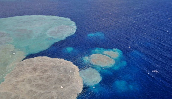
Based on reports prepared by the Institute of Environmental Hydraulics at the University of Cantabria, researchers have warned that although the society is unaware, the coasts of Spain "historically" have suffered the impact of "large" tsunamis, being the most affected areas the south-western Atlantic basin, especially the Gulf of Cadiz and the Mediterranean coast. These reports have been published in scientific journals such as Natural Hazard and Earth System Sciences.

More than 80 researchers (geologists, seismologists, physicists, engineers, instrumentation and communications experts or natural hazards) of 40 countries have gathered between 22 and 24 November at the Institute of Environmental Hydraulics at the University of Cantabria (IH Cantabria), specializing in the area of ​​excellence 'Water and Energy' of Cantabria Campus (ICC).

This meeting of the Intergovernmental Working Group to develop a tsunami warning system in the Eastern Atlantic, Mediterranean and Connected Seas (IOC / NEAMTWS), coordinated by UNESCO, includes among its participants with the researcher and professor of IH Cantabria the University of Cantabria (UC), Mauricio Gonzalez, who coordinates the working group 'Modelling and Risk'.

Gonzalez, in an interview with Europa Press has reported that, although most countries are developing their systems, "Spain is the only one who has not begun," "has not even started because there is no institution responsible for Warning System. "

"It can happen today or tomorrow"

According to the researcher has said IH Cantabria, the company''believes that these events occur every hundred or thousands of years,''but the truth is that''may happen today or tomorrow,''as has happened with emerging volcano island of El Hierro, exemplified.

People "have no idea" that tsunamis have occurred in Spain over the history even after the tsunami occurred in Indonesia in 2004 and recently in Japan, has started learning society "more" of the "dangers" of these events, said Gonzalez.

However, "we need to raise awareness, assess risk and meet the most vulnerable" to later implement in these areas "emergency protocol" for, at any given time "to react to local level," noted above.

In early 2012 Britain, France, Portugal, Morocco, Italy, Greece and Turkey, among others, will begin to issue their warning signs, and they all meet in the European system of alerts, but in Spain, there is a lack of a system , should there be a tsunami in Algeria or Cadiz - areas affected by faults - "when it arrives we can no longer give an alert and we will over react," he warned.

Gonzalez pointed out that all these countries " are developing systems" and launching "minimum requirements" to alert of these emergencies, while "Spain does not do anything," he criticized.

"In Spain, at the time the Civil Protection told a tsunami has occurred, for example, in Italy, will not be able to do anything, because there is no emergency first, second, because people will not be ready, what will you do, "Gonzalez has asked.

True, he explained, that the risk "areas exist in lagoons promptly" and although there have been no evidence yet on the whole coast "as it should do," have been studied areas such as Cadiz, Huelva and the Balearic Islands.

IN THE MEDITERRANEAN it will cause "major problems"

At the moment we know that in the Atlantic the risk is "high" and while in the Mediterranean "is not so high" if or when the tsunami occurred in one height of summer "would have major problems on the beaches, ports and the coast" due to the large number of citizens and tourists congregate in these areas, has detailed Gonzalez.

IH Cantabria investigator stressed that these events are occurring over time, "every ten years is a rather large and every 30 or 40 a very big" however "are forgotten generations and away of what has happened, "but if repeated in Cadiz as a tsunami in 1755 - known to exist through sedimentological studies -" it can become worse than happened in Indonesia. "

In 2012, when other countries start their warning systems, "if an alert comes to Spain we will not know what to do, so the danger is greater to know that an alert if it will give us just because we are not prepared, so run the risk, in that case, tragedy strikes, "he warned Gonzalez.

Alert System is Necessary

Therefore, this researcher has said that Spain needs a local warning system to detect earthquakes instruments underwater and thus tsunamis, as well as numerical modeling of execution of events that can occur.

Thus, if warned that a tsunami is produced in Turkey and we know its magnitude, it will "react" as they know how to act through the models made by computer.

Gonzalez has indicated that to develop this system to be studied Alert numerical models and the fault location and then evaluate and draw up risk maps, and with these, which are like "pictures of the reality of the situation," power measure not only the risk of high waves but to know which areas may be affected socially.

If that system was in operation at the time of the alert would trigger a "protocol", which also has to develop, which would involve law enforcement, emergency services and government.

El Hierro November 25 2011


Appearance of the stain on the eruptive area Wednesday. | DA

DIARIODEAVISOS.COM | SANTA CRUZ DE TENERIFE

The National Geographic Institute (IGN) has confirmed the direction of the Civil Protection Plan for Volcanic Risk (PEVOLCA) during yesterday there were 21 earthquakes on the island of El Hierro, none of them felt by the population.

The largest recorded magnitude was 2.6 on the Richter scale, an event occurred at 11:22 hours southwest of El Pinar at a depth of 13 kilometers.

Most movements are located in El Golfo, aligned NNW / SSE in the sea at a depth between 10 and 25 kilometers. Outside of this area and also above the earthquake was located one west of El Pinar at 08:10 hours at a depth of 13 km and a magnitude 2.0 on the Richter scale.

In total, since the day July 17, 2011 11 824 events have been found.


Tremor

The amplitude of the tremor signal has remained constant and low throughout the day with some slight increases in amplitude. It also confirms that there is evidence of a second source of tremor.

Deformation

In the horizontal components not seen any clear trend other than the regional. Vertically all stations show a clear tendency to collapse and those of El Golfo appear to indicate stability.

Evolution of the stain

Throughout the day has been increasing in size the area colored green emission increased, covering the end of the afternoon, a large area of ​​the west coast and northern part of the coast.

Thursday, November 24, 2011

Images El Hierro November 23 2011

Here are just some of the images released today that were taken yesterday by the Guardia Civil in a flyover of the stain in a Helicopter...


Satellite Image Volcano Mouths off La Restinga


Earthquakes return to the South of El Hierro


Earthquakes return to the South of El Hierro


The earth shook again south of El Hierro. The hypocenter, one just 13 miles deep, relatively more superficial than those occurring north of the island, which is usually around 20 kilometers. This has meant that, although its magnitude was not exceptional (2.6 the shallowest) have been felt by the population.The relative novelty (in that zone earthquakes began four months ago) makes people wonder if re- will open new mouths. A council spokesman explained that the island's south, in front of La Restinga, there is a fissure process, so you can not talk of mouths themselves.

Technicians from the National Geographic Institute (IGN) do not believe that, for now, this apparent novelty has a special significance on the evolution of the phenomenon. In general, the number of earthquakes is stable every day.

No islet off the coast

The potential arising island by submarine eruption in the area of ​​La Restinga on the island of El Hierro, "it will surface," according to volcanologist statements and vice president of the Bar Association of Geologists (ICOG), José Luis Barrera, collected by Europa Press.

For Barrera, as they are evolving events do not seem to come to see the popular rooster tails or eruptive plumes. This indicates that the submarine crater of the volcano continues about 200 feet deep. "It is possible that part of the structure has collapsed, as the lava running down the canyon and the cone does not grow in height," acknowledged the vulcanologist.

The volcano of La Restinga came to 300 feet deep, and 14 days, rose about 100 meters, a growth rate of about seven meters per day. "If progress in height would require that the base is broadened considerably to be stable in the vertical growth, or that is a huge volume of material that does not seem to happen", admits expert.

These statements further cool the mood of the 10,900 inhabitants of the island, which would be at the birth of an island the only possible compensation to the disorder that have been subjected in recent months, first by the seismic crisis and then by the eruption underwater. The expansion of a spot of volcanic material that covers most of the coast prevents fishing and diving, two of the main sources of income for the island.

The Museum of Barcelona presents the first 'restingolitas'


The Museum of Barcelona presents the first 'restingolitas'


Europa Press, Barcelona (24/11/2011. 07:30 am)

The Natural History Museum of Barcelona, also known as Museu Blau, exhibits from Wednesday the first rocks from the underwater volcanic eruption on the island of El Hierro, as reported by the City Council of the Catalan capital in a statement.

The stones were collected on October 19 in the Sea of ​​Calm in the south of the island, by a neighbor called Peter Canomanuel, who has decided to donate to the museum for exhibition.

The material found has been dubbed 'restingolita', for being near the village of La Restinga, and is characterized by a dark surface formed by basaltic magma that cooled very quickly, which provides a greater contrast with light colored interior and composed of volcanic glass with high silica content.

The museum displays has stated that after they have found this double-ended, so that the exhibition will include an explanation of the stone and a recent chronology of the eruption.

The rocks are considered one of the youngest in the world, and have been integrated in a display case within the scope of Rocks and Minerals from the museum's exhibition Living Planet.

Wednesday, November 23, 2011

The Pevolca allows selective opening of the tunnel in Los Roquille


The direction of the Civil Protection Plan for Volcanic Risk (Pevolca), has authorized the selective opening of access roads to the tunnels Roquille to reconcile the needs of users while avoiding the risk of landslides in the slopes adjoining the tunnel, as well as the risk involved in driving on the road to the summit in bad weather.

In this sense, at the request of the City of La Frontera and El Hierro council establishes the selective opening of the roads mentioned, at the direction of Frontera - Valverde at 6:30 and 7:00 pm, and at 19:00, 19:30 , 20:00, 20:30 and 21:00 hours. Also it enables the opening, meaning Valverde-Frontera, at 6:45 hours and at 19:15, 19:45, 20:15, 20:45 and 21:30 hours, reports Pevolca.

The selective opening allow vehicles that are at that hour at the entrance to the road that now remain closed between 18:30 pm and 7:30 am, will travel in convoy and with the monitoring of council highways staff El Hierro, supported by Security Forces, which use extra caution and attention to evidence of possible landslides.


 EARTHQUAKES

On the other hand, the National Geographic Institute has confirmed this morning to address the Civil Protection Plan for Volcanic Risk (Pevolca) during yesterday 35 earthquakes were located mainly in the area of El Golfo in the alienation NNW -SSE. Only two of these movements were felt by the population with intensities II and III.

The first occurred at 16:46 (UTC), located approximately 1 km from the coast and 22 kilometers deep and had a magnitude of 3.3 on the Richter scale. The second, with the same magnitude, occurred at 21:08 pm (UTC) located approximately at the coast and 17 kilometers deep.

In total, since the day July 17, 2011 there have been registered 11,804 Earthquakes.


STAIN

The stain caused by the eruption follows its course underwater off the coast of La Restingait was visible throughout the day. In the reconnaissance flight that was carried out by the IGN staff on board the helicopter of the Canary Islands could be seen in his head a light brown color. The green hue extends superficially focusing on large areas or circular shapes, as on previous occasions.

DEFORMATION

The results of processing of data from GPS stations show that the horizontal components of the deformation maintain the same pattern of stability, with some slight trends irrelevant. Vertically, all stations in El Hierro show deflation, except those of El Gulf that show stability or a slight rise in those located further west.


TREMOR

The amplitude of the tremor signal has remained constant throughout the day with minor variations not relevant. No evidence of a second source of tremor


New Vent opening, El Hierro November 23 2011


Earthquakes return to El Pinar


Earthquakes return to El Pinar


DIARIOELHIERRO.ES, writing (23.11.2011. 12:22 pm)

The seismic activity that has not stopped a single day in La Frontera, seems to have returned, at least temporarily, the municipality of El Pinar, who from the submarine eruption of La Restinga had been a notable decrease in the number of earthquakes.

Thus, the volcano monitoring network monitoring 24 hours of National Geographic Institute (IGN) has filed today in this town of El Hierro two earthquakes of 2.0 and 2.6 magnitude on the Richter scale. The first was located at 08:10 am in the west of El Pinar and 18 kilometers deep.

The second quake today in this town in the south of the island occurred at 11:22 pm in the southwest of El Pinar and 13 kilometers deep.

The other earthquakes have been located in the northwest and west of Frontera, between 15 and 20 kilometers deep.

According to the National Geographic Institute (IGN), and could be subject to change, so far there have been 11 earthquakes in El Hierro on Wednesday.

Tanganasoga Vulcano, El Hierro, Inflation

All Text extracted from Volcanocafewordpress.com

This will be a rather short post. During the last day I have received some information regarding Tanganasoga. Apparently it has been known for some time, but held back from the general population of El Hierro, that Tanganasoga is suffering from rapid inflation due to magma injection.

The Inflation
Even though I had two individual sources stating this, I still wanted to have additional confirmation before I wrote about it. After all, now we are talking about a volcanic feature that possibly can cause fatalities. So to get a bit of confirmation I asked GeoLurking to make a plot of the current uplift. It seems to indicate that there is an ongoing inflation in the Tanganasoga volcano.


Carbon dioxide map
CO2 is one of the premier gasses when you try to judge a volcanoes state. If you have an increased emission from a volcano you have yet another precursor to a possible eruption. As can be seen on the image below the area of Tanganasoga is leaking CO2 quite badly right now. The northwestern red area is related to the Roques de Salmor gas-vent.


Tanganasoga inflation
The inflation of the Tanganasoga Volcano puts strain on the rock face pointing down towards the village of Los Llanillos. As the rock face is put under strain it will sooner or later start to shear and parts of the rock face will start to come loose and fall down.
There is also a small risk of a lateral collapse of the mountain side if an eruption occurs at Tanganasoga. I am not saying that it would be like Mount Saint Helens, the pressure is just not there. But, between 0.5 and 2 cubic kilometer of rock going down into the bay is not good news. And then on top of that, magma flowing down after the falling rocks. Well, I for one would not like to be in the way of it all.
Let us be clear on one thing, I am not saying that there will be an eruption at Tanganasoga. But the pressure build up on the rock alone requires diligent monitoring. And the political will to evacuate Los Llanillos if there is an increased risk of a larger rock fall due to mountain tension. If the risk increases even more, which I think is likely after seeing the CO2 map. They need to make serious preparations for evacuation of everything from Frontera to Sabinosa. Because if there is an eruption at Tanganasoga there will be rockslides, magma flows, and yes even the small risk of pyroclastic flows. And it will all most likely be going into the town of Frontera, so there is not being any leeway for risking a non-evacuation. It is time for the small boys of IGN, Pevolca, Involca and the rest to grow up, and grow a pair.

Update November 23 2011


Picture where you can appreciate a magma emission point in the direction of the fissure in which it is "engaged" the volcanic cone

This fissure is "engaged" the volcanic cone and main broadcast center from the eruption that began in mid-October. The intense bubbling points have already appeared on other occasions, as was observed on 4 November. This new process of degassing pulses confirms the existence of sudden shock or gas by submarine eruptive activity south of the shoals that disappear later, but they are of great use to detect and locate new sources of emission or associated with this eruptive mouths volcanic process.

Institute scientists volcanological de Canarias (Involcan) have confirmed the direction of the Civil Protection Special Plan for Volcanic Risk in the Canary Islands (Pevolca) the observation of a new sudden release of volcanic gases by the Unit for Helicopters Civil guard in the Canary Islands at 11.40 hours on Monday. This visible emission of volcanic gases was located about 200 meters away to the east of the main zone of gas emissions and volcanic material occurs south of the Restinga from mid-October 2011.

Following these observations, we proceeded to the shot and thermal imaging in air mobile position associated with this significant and degassing again by volcanic activity in human and technical resources of Involcan under the partnership agreement between the two institutions on the implementation and use of thermography to strengthen the monitoring volcanic Canary Islands. Upon returning to the area with scientists from Involcan, the intensity of the fumes disappeared, as has occurred in some previous occasions (November 4, 2011).


El Hierro Registered 6 Earthquakes in the Night

El Hierro Registered 6 Earthquake in the Night

DIARIOELHIERRO.ES, writing (23.11.2011. 6:27 pm)

The National Geographic Institute (IGN) has registered on the island of El Hierro until 4:57 am this Wednesday, November 23, a total of six earthquakes measuring between 1.7 and 2.4 magnitude on the Richter scale.

The largest earthquake detected so far, has been the 2.4 magnitude. This earthquake occurred at 4:28 am this morning, in northwest Frontera and 17 kilometers deep.

According to the National Geographic Institute (IGN), and could be subject to change, the 6 earthquakes have been located in the northwest and west of the town of La Frontera, in the sea, and between 15 and 20 kilometers deep.

Two Earthquakes were felt yesterday

For its part, the National Geographic Institute (IGN) registered yesterday, Tuesday, two earthquakes of 3.3 magnitude on the Richter scale felt by the population. The first was recorded at 16:46 pm in the Northwest Frontera, 22 kilometers deep.

The second was located is also located in the northwestern Frontera and 17 kilometers deep.

Tuesday, November 22, 2011

El Hierro, la historia en imágenes hasta ahora ..El Hierro, the story so far,..


Involcan Scientists detected a sudden gas emission south of La Restinga


Involcan Scientists detected a sudden gas emission south of La Restinga


DIARIOELHIERRO.E, writing (22.11.2011. 15:45 pm)

Scientists at the Institute of the Canary Islands Volcano (Involcan) have confirmed to the direction of Civil Protection Special Plan for Volcanic Risk in the Canary Islands (Pevolca) the observation of a new sudden release of volcanic gases observed by the Unit Guard Helicopter civil Canary at 11:40 pm yesterday, Monday 21 November. This visible emission of volcanic gases was located about 200 yards east of the main zone of gas emissions and volcanic material occurs south of the Restinga from mid-October 2011.


Upon returning to the area with scientists from Involcan, the intensity of the fumes disappeared, as has occurred in some previous occasions (November 4, 2011). These observations confirm the existence of shock or sudden pulses of gas by submarine eruptive activity south of the Restinga then disappear but are of great use to detect and locate new or mouths emission sources associated with this eruptive volcanic process. The geographic coordinates of this new sudden release of gases has been North 27 º 607547 - 991288 -17 º West, reports the Involcan.

Monday, November 21, 2011

A Forecast Remains of a 4.6 Earthquake


A Forecast Remains of a 4.6 Earthquake

DIARIOELHIERRO.ES, writing (21.11.2011. 16:05 pm)

The scientific group of Civil Protection Plan for Volcanic Risk (Pevolca) confirmed this morning that in El Hierro, that an earthquake with a maximum magnitude seismicity expected of 4.6, taking into account "the analysis of the seismic catalogue of the past twenty days" .

In any case, the number of earthquakes has decreased in recent days, and frequency, producing a significant record in the early hours of Saturday to Sunday "with a wave of magnitude 3.7".

Scientists confirm that the seismicity occurs in the same alignment NNW SSE, in the municipality of Frontera, but always at a depth of between 15 and 27 kilometers. The evolution of the eruptive process, therefore, "remains stable, but leaves open the scenario of a possible eruption in the North, who has not, in any case, showing characteristcs of an imminent eruption."

The tremor remained very irregular yesterday, say Scientists

The tremor remained very irregular yesterday, say Scientists

DIARIOELHIERRO.ES, writing (21/11/20011. 13:04 pm)

The scientific committee announced on Monday to Pevolca the tremor signal was held yesterday, Sunday, very irregular during the day, with several pulses of different sizes. In the morning were similar to those at the end of Saturday's final stretch, but after 17:00 pm there was a slight decrease. In the analysis of the data it is not evidence of a second source of tremor.

Meanwhile, ground deformation follows the same pattern of stability in previous days in the horizontal components. Vertically stations indicate El Golfo, mainly, to a slight elevation, while the rest shows deflation.

With respect to the stain, IGN reports that there was no distinct coloration and surface activity in the area where in earlier days was bubbling, reports Pevolca.

EARTHQUAKES

On the other hand, the National Geographic Institute located during the day yesterday, Sunday, a total of 24 earthquakes at depths between 15 and 27 km, four of them felt by the population with magnitudes of 3.7, 2.9, 2.8 and 2.7 on Richter scale.

The movement reached a magnitude of 3.7 on the Richter scale occurred at 3:15 pm (UTC) and was located 2 miles off the coast of Frontera at a depth of 21 kilometers. It was felt, mainly in the town of Tigaday.

Pevolca confirms that there is no new eruption in La Restinga


Members of the Helicopter Unit of the Guardia Civil and scientists from Involcan, during a reconnaissance flight. | Involcan


DAILY ANNOUNCEMENTS | Valverde

The scientific working group of the Civil Protection Plan for Volcanic Risk (Pevolca) states that "no one can confirm that new focus eruption has appeared in La Restinga, after a helicopter overflight of the area of GES with scientists from IGN.

As confirmed by the press office of the Presidency of the Government's twitter account, "The Pevolca confirmed after the helicopter reconnaissance flight of the GES that there is a new focus in La Restinga eruption."

In this way, belies Pevolca volcanological Institute of the Canaries (Involcan) after flying over the area of ​​La Restinga GES helicopter with scientists at the National Geographic Institute (IGN).

El Hierro Update

Data Update 21/11 – 08:12 UTC
The El Hierro volcano may get tired as the pressure of the magma seems to subside. Too soon to say that the activity will be over, but the subsiding harmonic tremor and the decrease in strength and number of earthquakes are indicators that the strongest eruption period  may be over
- 5 M+1.5 earthquakes since midnight
- Strongest earthquake being a 2.6 at 02:02
- Depth of the earthquakes since midnight : 17 to 22 km
- Gradually subsiding harmonic tremor since 03:00 today
- air quality remains GOOD at La Restinga for volcano related emissions

The Earthquakes do not stop


DAILY ANNOUNCEMENTS | Santa Cruz de Tenerife

The island of El Hierro registered at 3.27 am on Sunday, another earthquake felt by the population. The earthquake of 3.7 magnitude on the Richter scale, was located in the northwest of La Frontera, 21 miles deep, while another 2.9 degrees was also felt on the seven o'clock, also in the municipality of El Golfo.

Also at 03.04 am this morning there was localised a quake of 3.1 magnitude on the Richter scale in the northwest of La Frontera, 21 miles deep. At the moment, IGN does not collect this shaking which has been felt by the population. According to the National Geographic Institute (IGN), until seven in the evening of Sunday, El Hierro had recorded a total of 18 earthquakes of 1.8 and 3.7 magnitude on the Richter scale.

The strongest

IGN reported that the quake highest since the crisis began seismic El Hierro, on July 17, took place yesterday at half past two o'clock, when it recorded a 5.0 magnitude on the Richter scale in the area called Atlantic-Madeira, northwest of the island of La Palma.

El volcanological Institute of the Canaries (Involcan) has moved to the direction of Civil Protection Plan for Volcanic Risk Islands (Pevolca) the results of the 8100 diffuse flux measurements of carbon dioxide (CO2) on the island of El Sunday, El Hierro is have materialized over the entire surface of the island of Isla Meridian.

These measures reflect the registration of an upward trend of the diffuse emission of carbon dioxide (CO2) into the atmosphere by the volcano island of El Sunday, El Hierro has reached 1665 ± 63 tons per day, an amount equivalent to 4.83 times the considered normal average value for the diffuse emission of carbon dioxide (CO2) on the island of El Sunday, El Hierro (345 tonnes per day).

With this analysis assesses the spatial-temporal variations of the diffuse emission of carbon dioxide (CO2) into the atmosphere by the volcanic system island of El Hierro in the context of the recent earthquake-volcanic crisis affecting the island.

Escape of Gases

In studies carried out by Involcan, it is found that the gases represent the driving force of volcanic eruptions and carbon dioxide (CO2) is the second major component of volcanic gases after water vapor. Its low solubility in molten-magma-ago requested that this gas to escape with their ease of volcanic systems in depth, volcanological Institute reported yesterday in the Canaries.